Bash Bish Falls: READ THIS Before Hiking MA or NY
Is the Massachusetts or New York Hike Better?
We made a mistake while hiking Bash Bish Falls State Park in Western Massachusetts with kids... a sweaty, soggy mistake. This here article aims to keep you from our error! But first, let's get some background information.
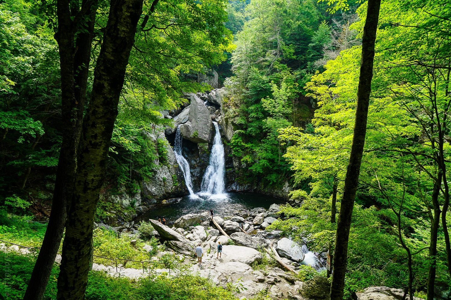
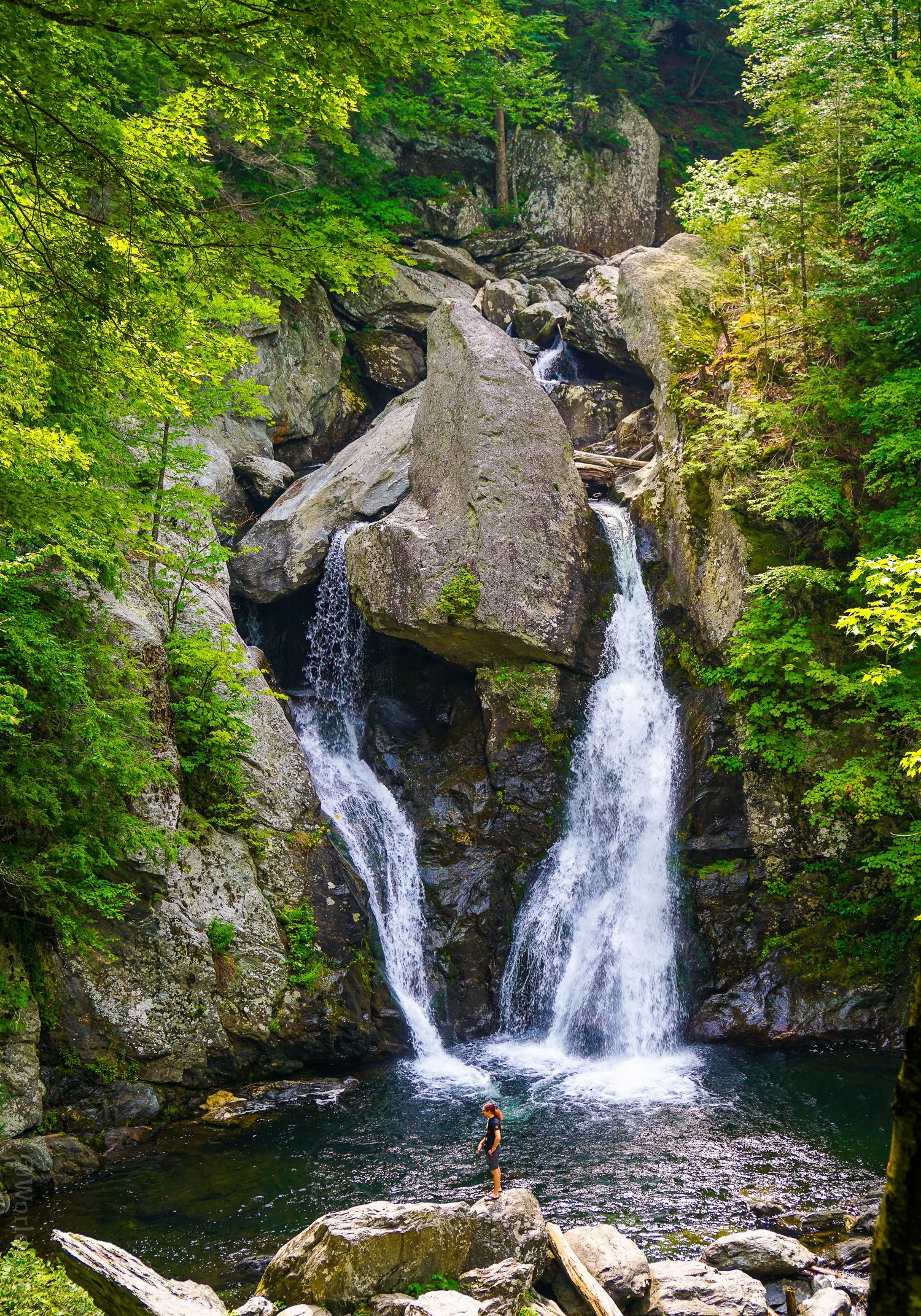
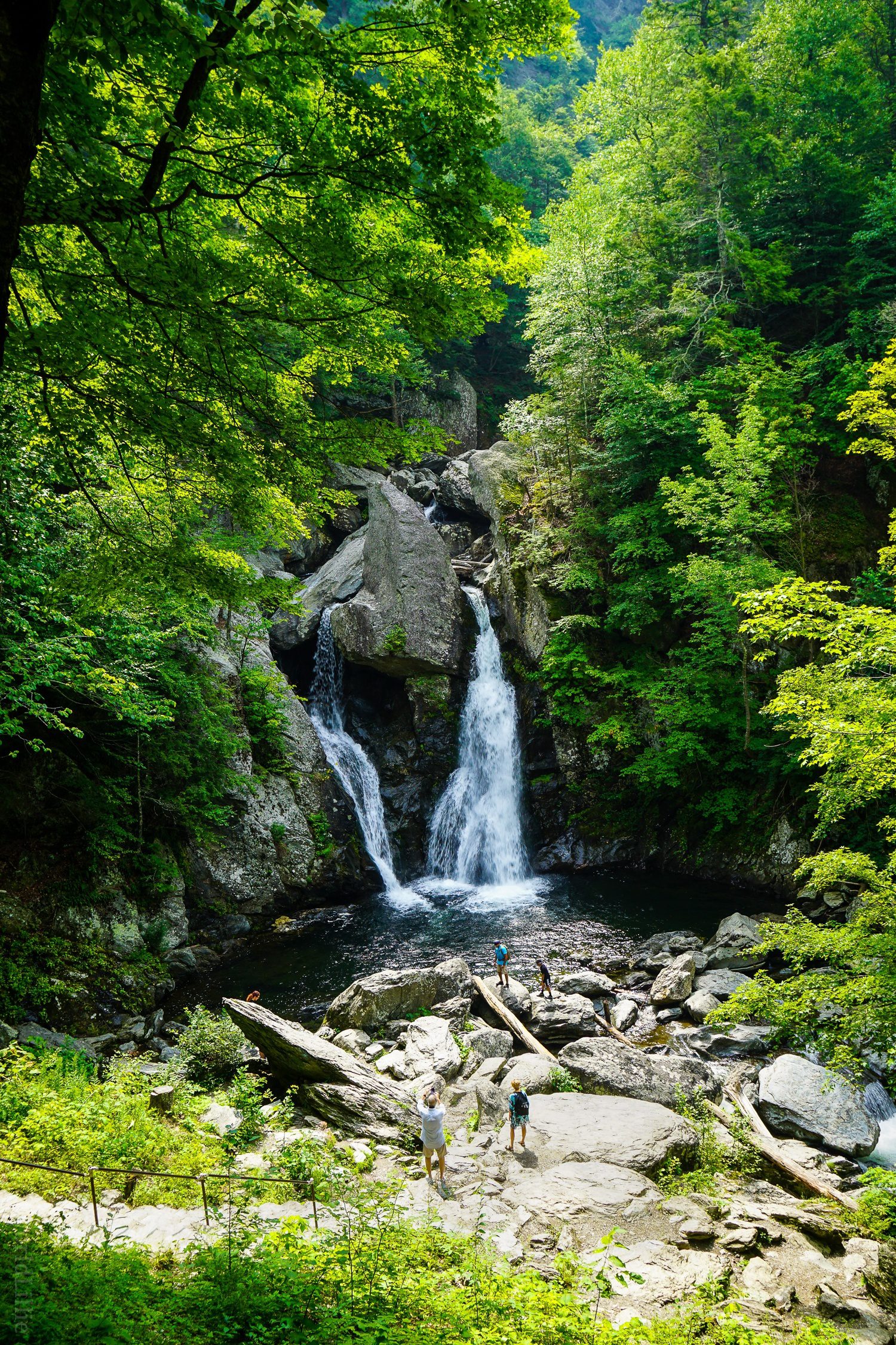
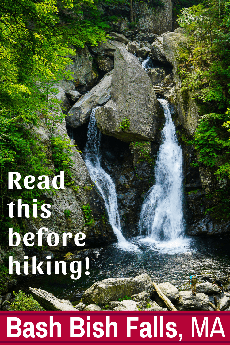
Bash Bish Falls is the highest waterfall in MA!
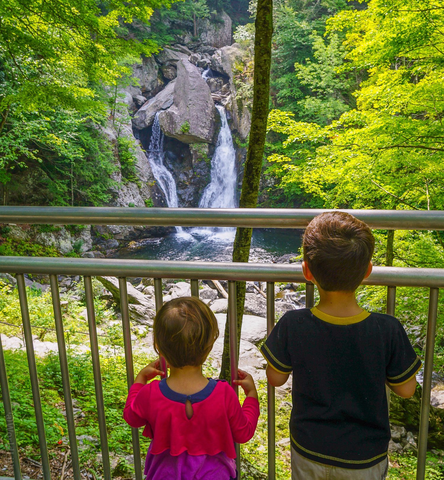
In its entirely, the Bash Bish water chute stretches nearly 180 feet tall. The final dramatic "V" plunge, with two side-by-side sprays on either side of a triangle-shaped boulder, plummets down a full 80 feet -- making it the highest single-drop waterfall in the fine state of Massachusetts.
Where is Bash Bish Falls, exactly?
Ahh... this geographical background is integral to you avoiding the mistake we made. You see, the waterfall of Bash Bish Falls State Park sits right at the edge of southwestern Massachusetts in the Berkshires. (Well, it's between several mountain ranges, including the Taconic Mountains and Mount Everett State Reservation, but the Berkshires are the easiest framework for we Western MA lovers.)
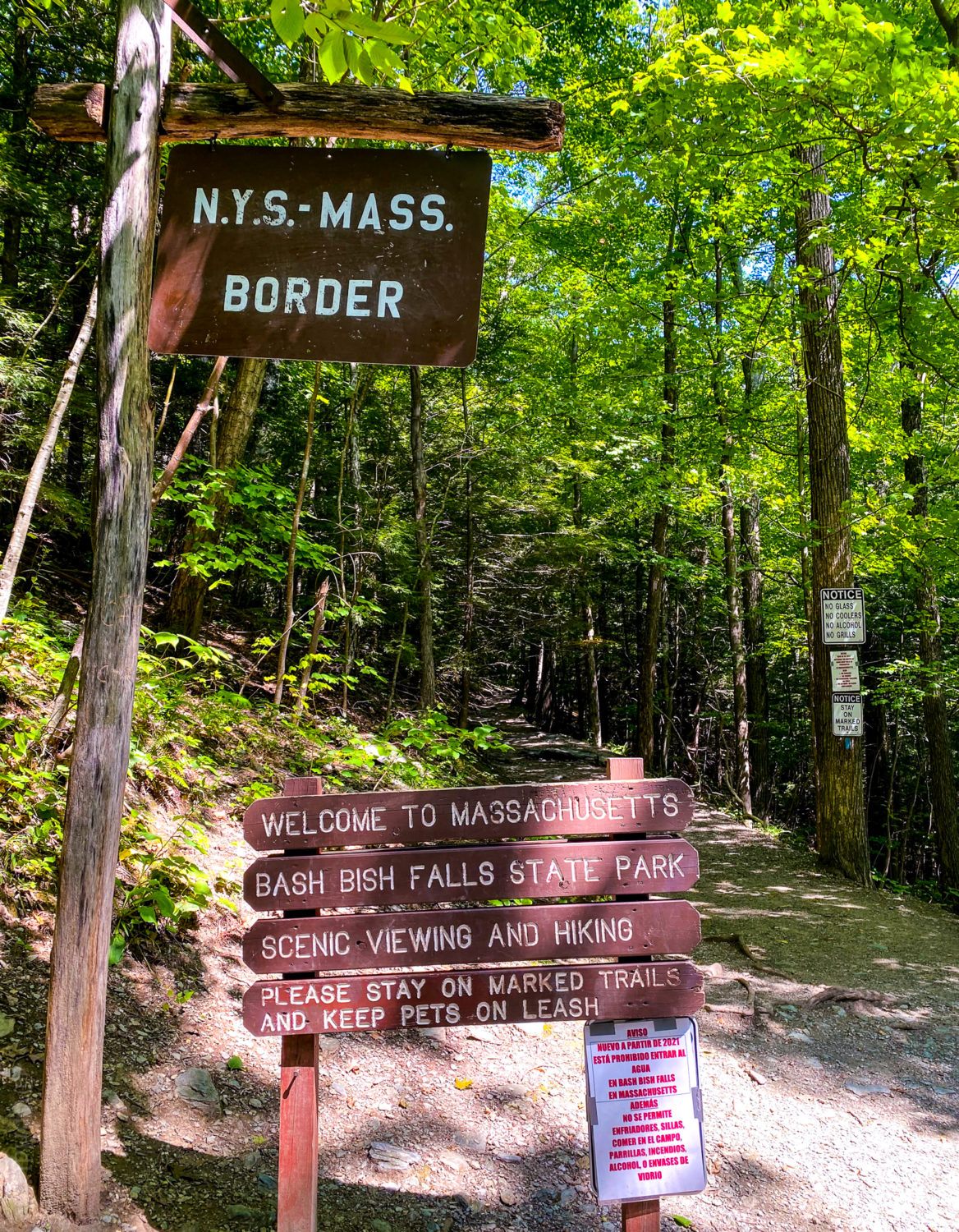
Less than a mile away lies the border with New York State. This means that the falls sits on the edge of Taconic State Park of NY, which in turn means...
There are TWO ways to hike Bash Bish Falls.
Choose wisely! (Cue dramatic music.) You can either hike to Bash Bish Falls from the Massachusetts side, or from the New York side.
Both have parking areas off the same road, which excitingly has two different names depending on the state: Falls Road in MA, and in NY, New York State Route 344. Both hikes are less than a mile long to reach your watery reward... but oooh my, are they different!

The MA side of the Bash Bish Falls hike...
Because we were hiking with my small children (2 and 4 years old), we saw that the Massachusetts side Bash Bish Falls State Park hike was only ⅓ of a mile, and that sounded like an easier alternative to the ⅔-mile NY option.
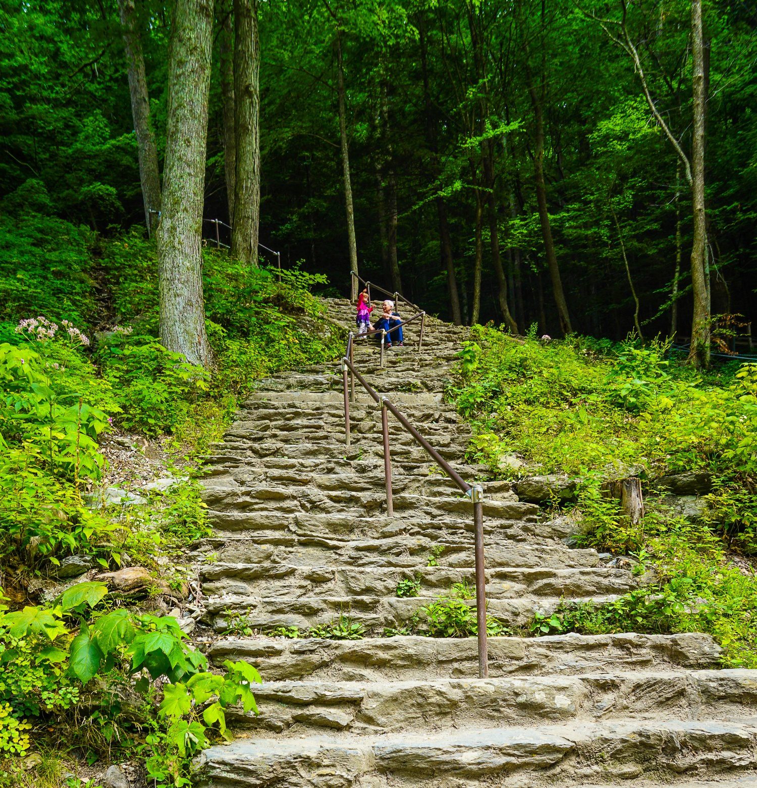
"Sure," we reasoned, "it says on the official website that it's a steep descent of 300 feet, but at only a third of a mile, how hard can that be? Ahem. The answer is, "about 15 different kinds of hard."
Is the MA side hike at Bash Bish OK for young kids?
Let me preface this by saying I am a strong and hearty lass with workout plans so robust, my biceps pop out of my shirts. I was doing this Bash Bish hike with my equally muscular mother, and extremely energetic kids.
Unforrrrrtunately, a descent of 300 feet over ⅓ a mile of slippery rocks looks like this:
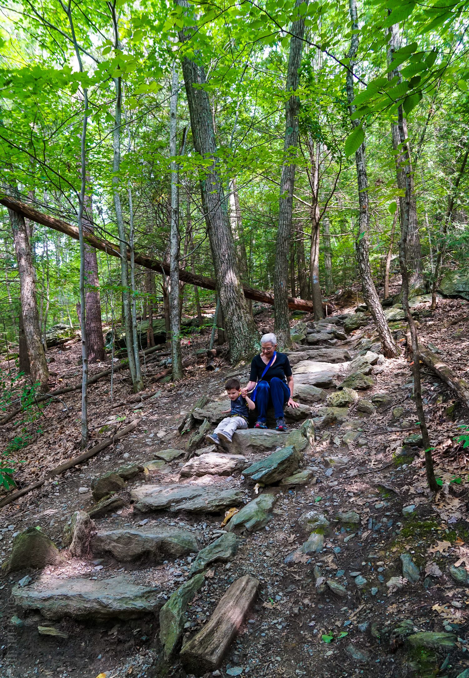
In short, to safely do the Bash Bish Falls State Park hike from the MA side, my son and mother spent half of their time scooting down slowly and steadily on their bottoms (as pictured above), and I did the whole thing while CARRYING my two year old daughter, because she got so scared of the loose rocks making her slip. My forearm muscle ached for the whole subsequent month!
It took us about an hour to do the whole third of a mile, as crazy as that sounds. But we did it! And got back up to the top again, too. Please note that I am choosing not to include the photo of my arms raised in triumph at the end because... sweat.
Hiking Bash Bish from the Taconic State Park, NY side:
I originally published this article several years ago, and back then I'd only glanced at the NY trail (wistfully) from the falls where the two paths meet up. Therefore I vowed in 2022 to finally go and do the New York side from Taconic State Park with my kids to fully compare. This new section is the result of doing the NY side hike this August. Ready to see what the easy side looks like???
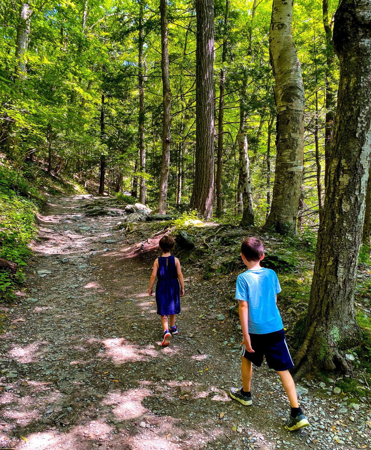
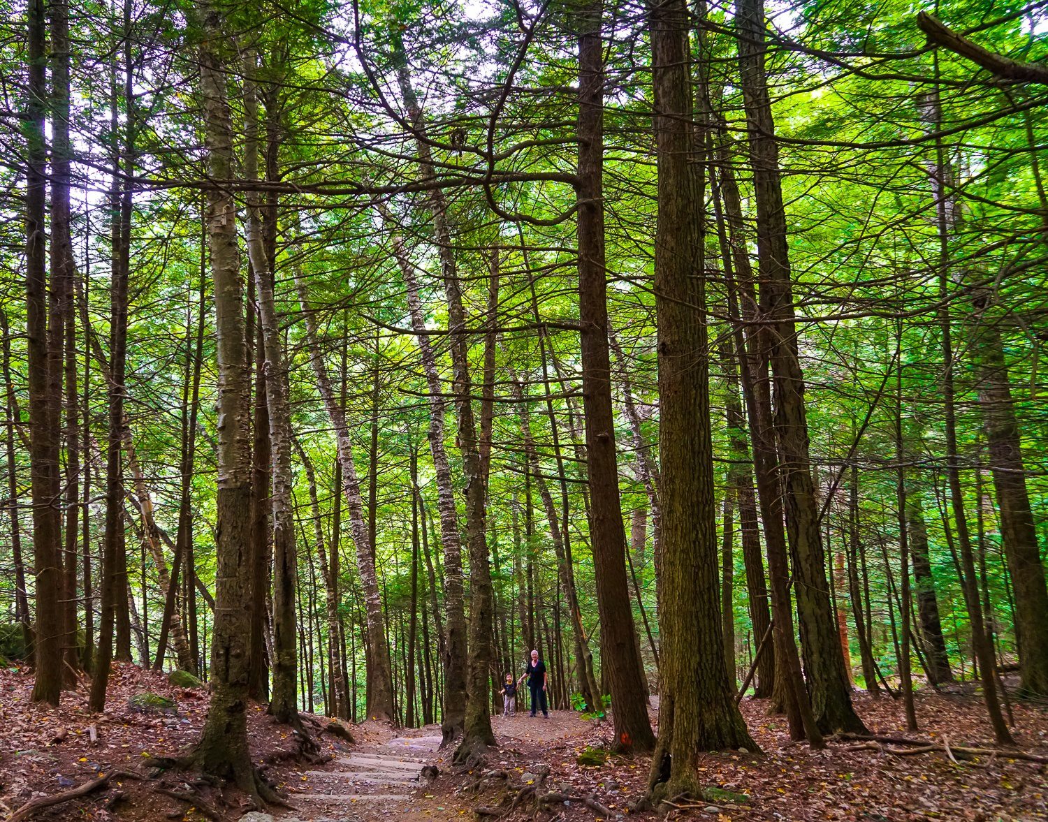
The NY Side Hike is WAY Easier!
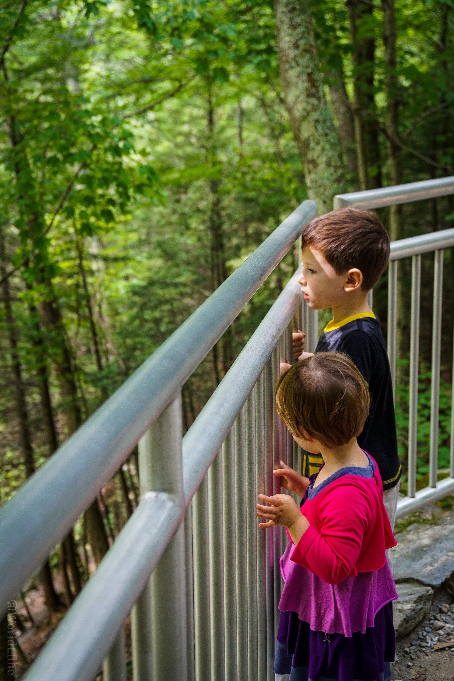
The NY trail from Taconic State Park to Bash Bish Falls is 1.5 miles round trip (¾ a mile each way), which is slightly longer than the MA side -- but it was suuuuuuch a better hiking experience than the MA trail! Why? The New York trail to Bash Bish from Taconic State Park is flat, wide, and smooth, except for a few rocks and roots.
You could probably even roll a stroller down the NY path to Bash Bish if you had one of those big-wheeled off-road baby carriers. We did the whole hike in a relaxed and happy hour, and emerged with smiles on our faces! Between the NY and MA sides, I'd take the NY side any day.
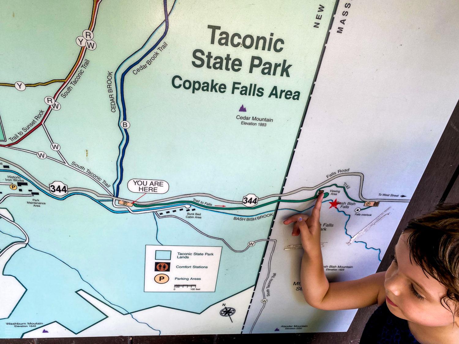
Finding the Trailhead to Bash Bish Falls in NY:
It can be a little tricky to put in the correct coordinates for the mouth of the Taconic State Park trailhead in New York to Bash Bish Falls. The map above might help, along with the address "396 NY-344, Copake, NY 12517." You want to look for signs for Copake Falls, then Bash Bish, and then there's a nice big parking area (replete with Port-a-potties).
To prepare if YOU hike Bash Bish Falls from MA:
Let me be clear: I am not saying the MA side of the Bash Bish Falls hike is bad. It's a beautiful, very doable hike for most people, with proper preparation. We just didn't put all the parts in place, ourselves! If YOU go, make sure to do the following:
• Fully think through whether the NY or MA side hike is a better match for your situation. If anyone in your party has issues with steep and slippery rocks, the NY side is a much better idea, and is actually not that much longer!
• Wear proper footwear. Sneakers or hiking boots are important for the uneven surface of the MA side hike.
• Bring water and snacks. We figured a ⅓-mile hike would be easy to do with no hydration, but didn't realize it would take so long! If you're worried about over-hydration, be relieved (literally) to learn that there are port-a-potties at the mouth of the hike and at the falls, themselves.
• Understand that cell phone service is very spotty, so don't rely on it to meet up with people for your journey.
Is Swimming Allowed at Bash Bish Falls?
Something we DID do well during our hike was not fall into the waterfall. That was a win. Sadly, Bash Bish Falls is known for being dangerous in that respect, so do mind the railings and edges if you venture down to the mouth of the falls, and remember that swimming is NOT allowed for a reason. in 2021 the park had erected barriers around the main waterfall, but when I returned in 2022, they'd been removed again.
Linguistic Question: Why isn't it BISH BASH Falls?
It was only in researching for this article that I realized I've been saying the name of the waterfall wrong for over 30 years. No, it is NOT Bish Bash Falls, it's Bash Bish -- named after a Native-American woman of legend. (A certain family member insists the name actually comes because one side of the V waterfall goes "Bashhhh" while the other sighs, "Bishhhh.")
But why does saying "Bash Bish" instead of "Bish Bash" feel so wrong on the tongue? My intellectual husband came to the rescue to answer this query. He explained that he'd recently been listening to a linguistics podcast by Columbia professor, John McWhorter, called Lexicon Valley. One episode was dedicated to the pattern in the English language to always put the "i" or "e" sound word before the "a" or "o" sound word.
Examples of this abound. Splish, Splash! Knick knacks. Ding dong! Mish mash. Click clack! Wishy-washy. Cling, clang! Ping pong... and even Cheech and Chong. Now do you see why Bash Bish's name feels like a triangle-shaped rock in your mouth???
If the waterfall really is named for a Native-American woman from the area, it looks like Algonquin was spoken in the Berkshires region, so perhaps those linguistic patterns of "a" before "i" sounds come from that language. If Professor McWhorter can weigh in on this, my husband will squeal with fan awe!
Vacations in Western Massachusetts:
Final tip: I HIGHLY recommend the entire area of Western Massachusetts for vacation, be it for two days or two weeks. (See my big list of what to do in the Berkshires!) The region is lovely, and has so much to offer, including Mount Greylock (the highest mountain in MA), a fabulous alpaca farm, this teeny tiny airport with baby planes, the historic and quirky Red Lion Inn, and the famed MASS MoCA museum.
If you're staying for more than a few days, renting a house is often the most affordable and enjoyable option. Feel free to use this easy affiliate link to Vrbo (formerly called VRBO) Western MA rentals to support this site at no extra cost to you. We've tried both services and had excellent experiences.
So what about YOU? Have you been to Bish Bash -- er, I mean Bash Bish Falls State Park? What was your experience? If not, does it seem like a place you'd like to visit? Do share!

The author, Lillie Marshall, is a 6-foot-tall National Board Certified Teacher of English, fitness fan, and mother of two who has been a public school educator since 2003. She launched Around the World “L” Travel and Life Blog in 2009, and over 4.2 million readers have now visited this site. Lillie also runs TeachingTraveling.com and DrawingsOf.com. Subscribe to her monthly newsletter, and follow @WorldLillie on social media!

You should try Tannery Brook Falls off the Mohawk trail, in May when there is still plenty of water. I makes Bash-Bish Falls (which is also very nice) look puny. However, there is only one way in and out, and it is quite steep (and slippery in May), and not suitable for small children. However, I am 77, and had no problem making it down and back up again, although it was a pretty good cardio workout.
Hi Charlie,
Thanks so much for the tip on this other hike! I'll have to try it out soon. Appreciate you taking the time to share your advice!
Haven’t been for years. Used to be a frequent destination. Disappointing to see it barricaded off due to lack of respect, or any other reason really, for this beautiful place.
This could have been shortened with “the MA trail side is way steeper. Also staff has since out up barriers so take that into consideration if the drive is still worth it”
I'm about to add some updates from my recent March, 2022 visit -- as of this spring, looks like barriers have been removed. I'm not sure if they'll be adding them back this summer.
I haven't heard of Bish Bash Falls before but this looks like an amazing waterfall hike in MA!
It's a New England gem!
Our family loves to hike and this spot looks amazing! I like that there are two options to reach the falls, depending on how adventurous you're feeling and if traveling with little kids.
Right?! So great to have options!
Wow! These hikes look amazing! ...And those steps down to Bash Bish Falls are super cool. We'd love to explore this area sometime!
The NY side is such a satisfying hike!
Great pictures of the falls!!! I must say your picture is the only one that convinced me the grand-scale of Bash Bish Falls - Great eye! All the other pictures I've seen online makes it look like a measely tiny waterfall despite it being the tallest one in MA. I'll def be checking this out as I head out West. And it's funny that you mentioned the linguistic error of us wanting to say "Bish Bash" bcs I've been doing it non-stop until I realized what I'm wrong??
did you use a wide angle lense??
Haha! Yes, our "biggest" things in Massachusetts are sometimes a little puny! I did use a wide angle lens (16mm), too, so that contributes.
This hike looks amazing! ...And you included every detail that anyone would ever need for a great day here! Thanks for taking the time to share these details :)
Don't want anyone to make the sweaty mistake we did unless they want to!
Wow, I can imagine the wet soggy hike was so disappointing. Here's another option, a guided tour. We had several choices on the trails. It was great to be outdoors and be safe AND unplugged. The company is Berkshire Camino and it was inspired by the Camino in Spain. We walked through the woods for house and were completely surrounded by natur, but the path was nice and easy. I like just being able to relax and having someone in the lead so we could just enjoy. Most of the time we were just in the woods but at the end we walked through the Gardens of Edith Wharton's estate on the trail we chose. Really, I think anybody could enjoy Berkshire Camino. I booked my tour online. I'll leave the website below in case anybody's interested.
Thanks for the tip! Guided hikes can be very helpful.
Bish Bash Falls look spectacular! And thanks for the linguistics intel :)
Opps make that Bash Bish ;)
Nice catch!!! The "Bish" is so tempting to put first...
I'm ALWAYS up for waterfall hike! And the Bish Bash Falls look beautiful.
Ooo -- the trick got you! It's Bash BISH!
Hiking to a waterfall has to be one of our favourite things to do! That looked like it was tough going but a waterfall is always a worthy reward.
So true!
Well at least you have an epic tail to tell!! And you can be so proud of doing the harder hike, right??? We'd love to explore this area with a certainly wonderful watery reward!
Haha, true -- It was hard going but made a good story once we made it back and caught our breath! A nice metaphor for life, perhaps.
Spectacular falls! Absolutely love its name too. Hiking in greenery to crashing waterfalls is one of my all time favourite weekend activities. Living in the UK we get plenty of rain to keep them topped up!
Reaching the waterfall is such a dramatic reward!
You had me at waterfall. And Hiking. Great photos and looks like a fantastic family-friendly hike.
Waterfall hikes are such a great combo! The dramatic reward at the end of the hard work!
I love the name of these falls! And so good to know your rec to start the hike from the NY side. So helpful!
The name is half the fun!
Fun fact: the reason we want to say "Bish Bash" is called the rule of ablaut reduplication. You can read more here!
http://www.bbc.com/culture/story/20160908-the-language-rules-we-know-but-dont-know-we-know
Whoa!!! Thanks for sharing this! I'll have to show Colin!